Collaborative projects
In addition to our own research, Field School contributes to a number of ongoing projects through active data collection and public engagement. Below we describe some of these projects and link to their main webpages.
|
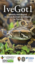
IveGot1
A mobile app project created by the Center for Invasive Species and Ecosystem Health, helps to map the location of invasive species in Florida using the work of citizen scientists. Click here to download the app. |
|
Marine Debris Tracker
A joint project with NOAA Marine Debris Division and the Southeast Atlantic Marine Debris Initiative at the University of Georgia, this app helps to categorize and map the extent of marine debris pollution through citizen science. Learn more and get the app here. |
|
Secchi Phytoplankton Measurements
This public science project measures the amount of phytoplankton, minute organisms at the very start of the marine food chain, currently residing in the world’s oceans. Scientists fear the population of the microscopic beings is in decline due to rising sea temperatures and, if true, that could have consequences for every aspect of marine life. The project is being spearheaded by Plymouth University’s Marine Institute, which hopes to build a map of the oceans that charts the seasonal and annual changes of phytoplankton from now and into the future. Click here to learn more and get the app. |
|
The Great Annual Fish Count
Organized by the Reef Environmental Education Foundation and held in July each year, the GAFC gets divers and snorkelers involved in documenting fish diversity and population trends. The project aims to engage the public community in the status of the marine environments they love, educate people about science and the environment, and provide useful data to researchers and policy makers. Field School also participates in the year-round volunteer fish monitoring program in addition to the main event hosted in July. Learn more here. |
|
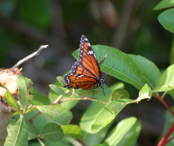
Monarch Watch
The Monarch Watch program has several ongoing research projects that rely on student and citizen science participation including tagging, larval monitoring, size and mass measurement, flight vector calculation, and hydrogen isotope signature tracking. Click here to learn more and get involved. |
|
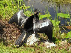
eBird
The eBird project was developed by the Cornell Lab of Ornithology and the National Audubon Society. This interactive online program engages the public in tracking bird habitat and species abundance. As Field School's main base of operations is located on bird migratory pathways, we are able to contribute valuable data on crucial bird habitat and population status. Learn more and find out how to participate here. |
|
Partner with us! We are always looking for new schools, scientists, and non-profit organizations to partner with. Please contact us here to start a conversation.
Hear from us! Sign up for our newsletter to hear about what is happening at Field School as well as upcoming offers and specials. |


